
(note: This Northern Ontario road trip took place in August 2020 during the COVID-19 pandemic.)
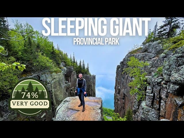
After our incredible time at Pukaskwa National Park (previous blog post), we were headed to Sleeping Giant Provincial Park for what would become one of the most challenging and rewarding hikes of our entire Northern Ontario road trip. The park is home to Ontario's tallest cliffs and offers some of the most dramatic views in the province. Keep reading to learn why this hike should be at the top of your Ontario bucket list!
On our drive from Pukaskwa to Sleeping Giant, we made a quick stop just off the highway to see the beautiful Aguasabon waterfall in Terrace Bay. After the previous night's torrential downpour, the falls were absolutely roaring. It's an easy stop that's worth the few minutes off your route.
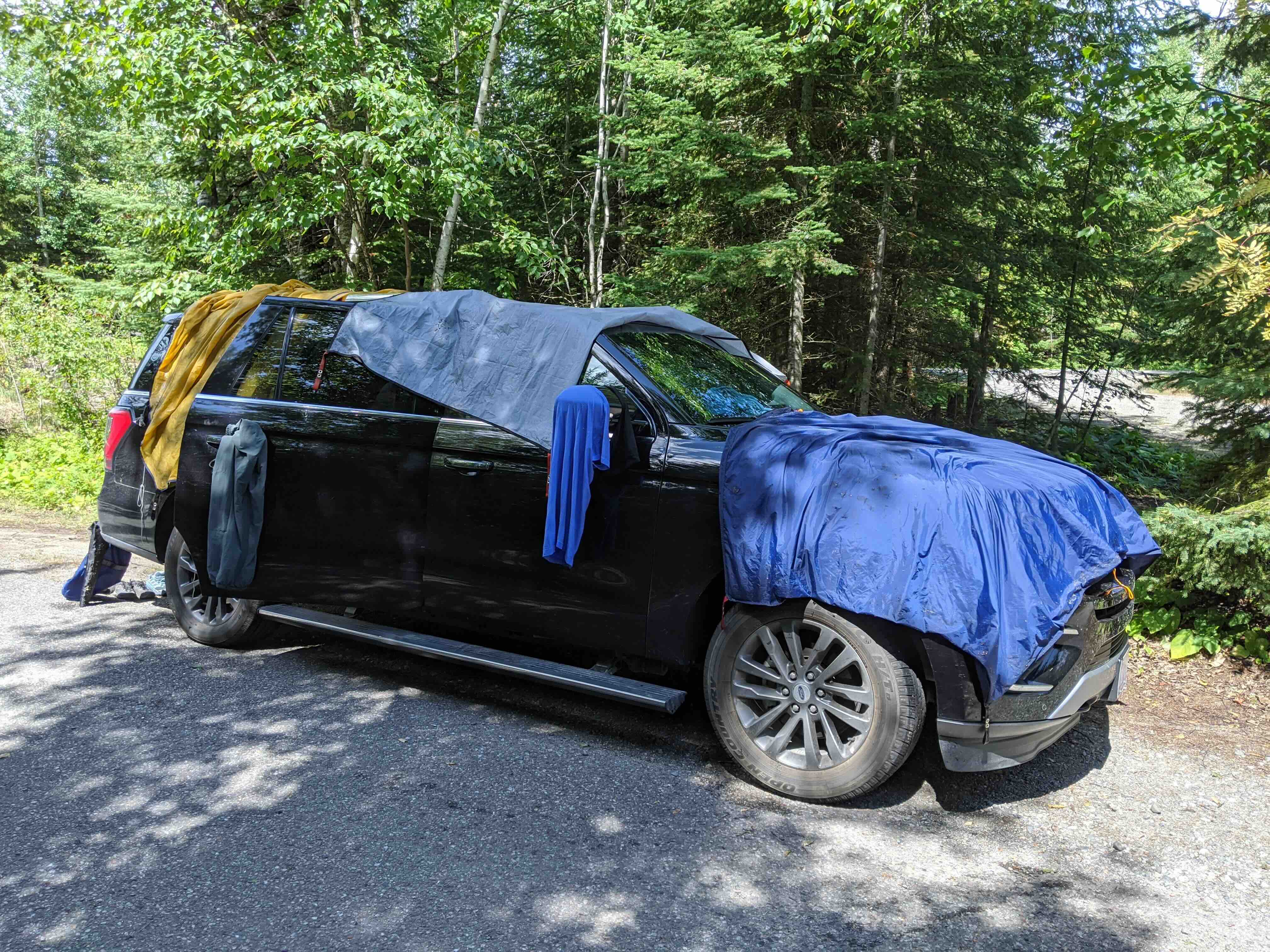
Speaking of that downpour, we were looking for somewhere to dry our tents in the sun while we ate. We found the perfect spot at a viewpoint just a 1 minute drive off the highway. With a bathroom, picnic tables, and a beautiful view of Lake Superior, we were all set. Sometimes the best moments on a road trip are the unplanned ones, and cooking breakfast with that view was definitely one of them.
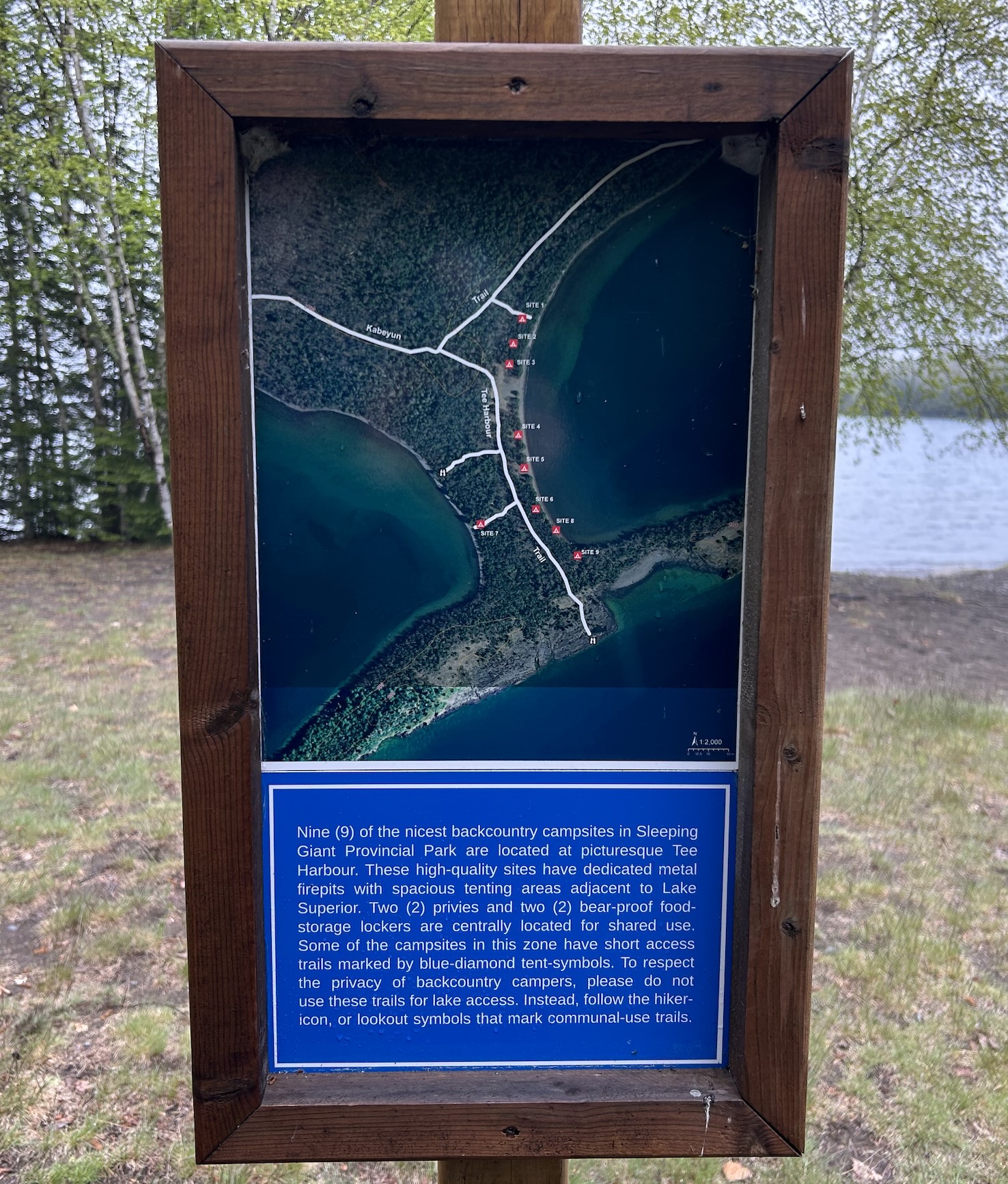
Our plan for Sleeping Giant was to backcountry camp Monday night and then hike to the top of the giant Tuesday morning. This is a great way to split up the 22 kilometre hike and ensures you can be one of the first to the top the next morning. There are 4 backcountry sites within Tee Harbour on the way to the top of the giant, and this approach meant we could tackle the challenging ascent with fresh legs.
⭐ Tip: There is no water tap at the trailhead, so you'll need to drive into the campsite area to fill up your water bottles before starting your hike. There are outhouses at the trailhead but they are VERY smelly, so it might be a better place for a washroom break before you head into the campground.
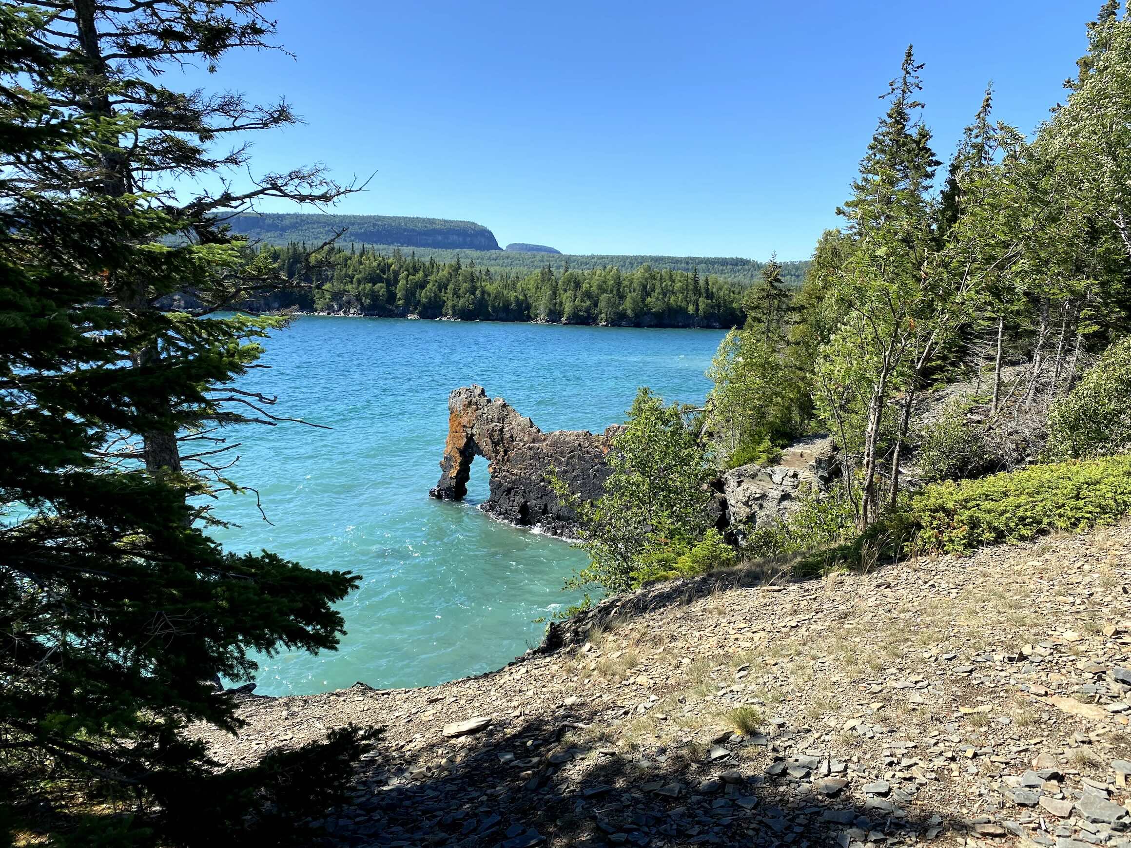
We started our hike at 4pm on Monday from the trailhead. After just 15 minutes, we reached the junction for the Sea Lion Trail, a 500 metre hike up to a lookout which gives you the best view of the famous Sea Lion rock formation. Although not the best view in the park, since it's such a short detour off the main trail, it's probably worth seeing just so you can say you've seen what all the hype is about.
⭐ Tip: We left our large packs off to the side at the start of the sea lion trail trail because it would be a tough climb up with full gear.
| Name | Sea Lion Trail |
| Distance | 500m, 10 minutes |
| Terrain | Rocky climb |
| Level | Moderate |
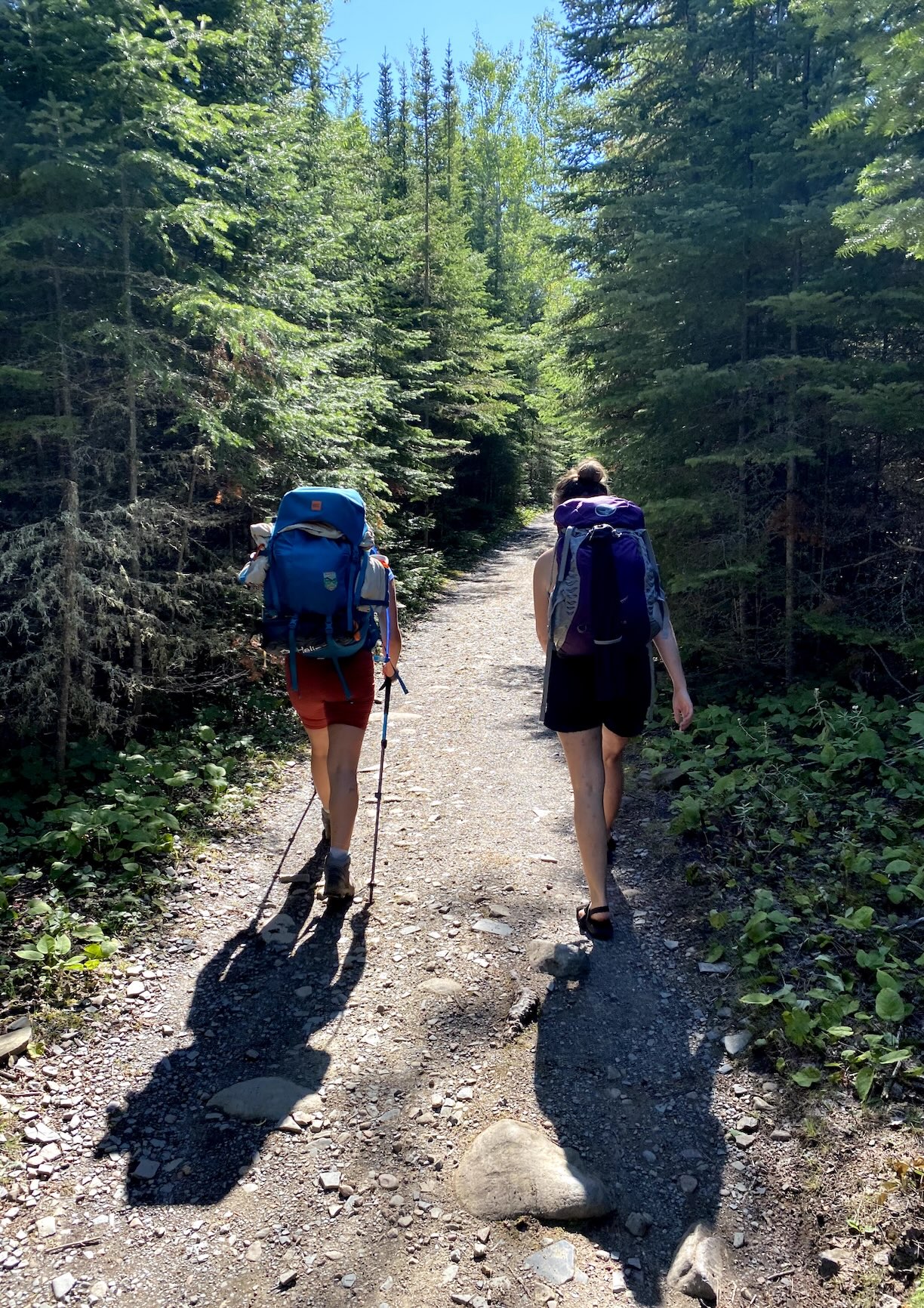
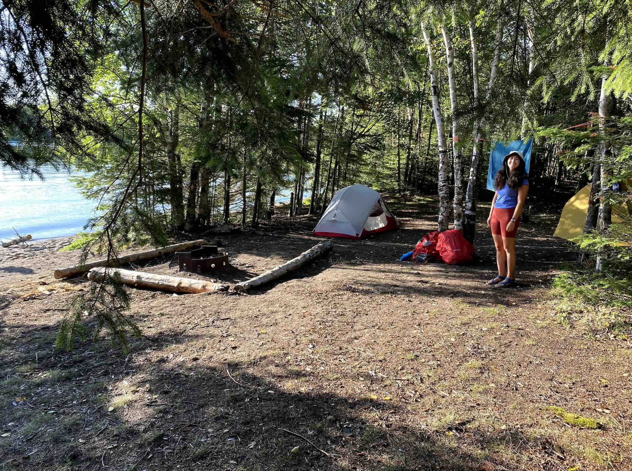
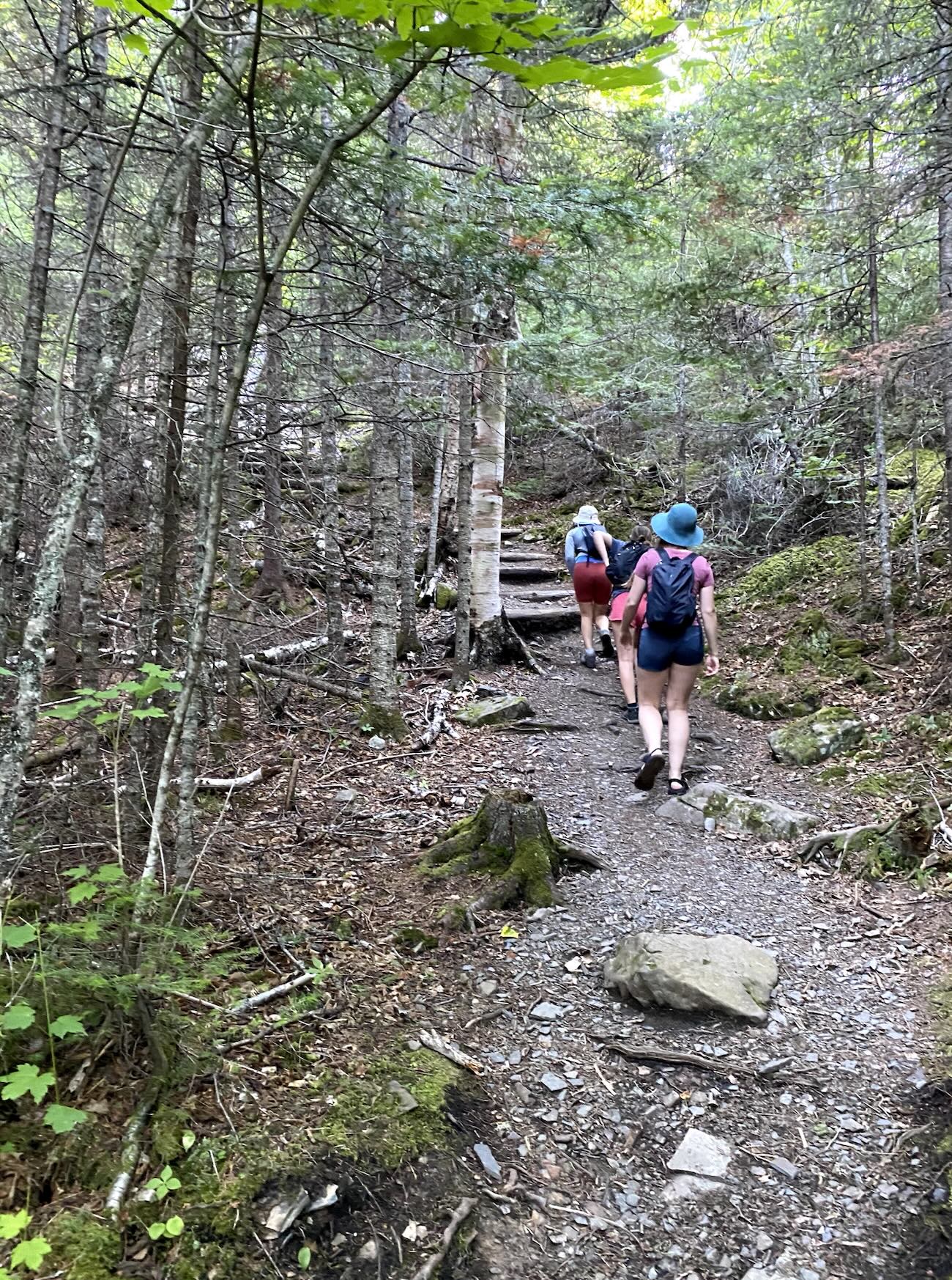
The trail to Tee Harbour is pretty flat and wide. You'll be sharing the path with other day hikers and lots of bike riders. There isn't too much to see along this 1 hour mostly flat walk other than trees, but it's a well-needed break if your plan is to hike to the top of the giant the next day. After 1 hour of hiking, you get to the first campsite. The tent spots are within the forest, but it still has a fire pit and bench setup with a view of the water on a rock beach. The only downside to this site is it doesn't have a good locker, so you'll need to tie up your food.
Another 20 minutes down the trail takes you to the rest of the Tee Harbour Bay campsites. These sites are all right on the lake and share 1 food locker that's been divided into 3 sections. These sites are definitely better than the first site you come across, but you'll need to risk giving up your first site and hoping the next ones are available.
| Name | Tee Harbour Trail |
| Distance | 7km one way, 1 hour 20 minutes |
| Terrain | Flat, wide path |
| Level | Easy |
We left our campsite at 8:45am Tuesday morning so we could hike before the midday sun. The hike from Tee Harbour Trail Junction to Sleeping Giant Trail Junction is 1.8 kilometres. This part of the trail was pretty flat and wide, similar to the hike to Tee Harbour the day before. Once you get to the Sleeping Giant Trail Junction, you'll see bike racks which mark the start of the Top of the Stairs trail. After another 10 minutes of hiking, you'll pass a beautiful green meadow. This is another great photo opportunity but also a good place to watch out for wildlife. Although we didn't run into any bears, a few days before, a colleague came across one right on the trail here which didn't seem to be scared by hikers as they tried to pass.
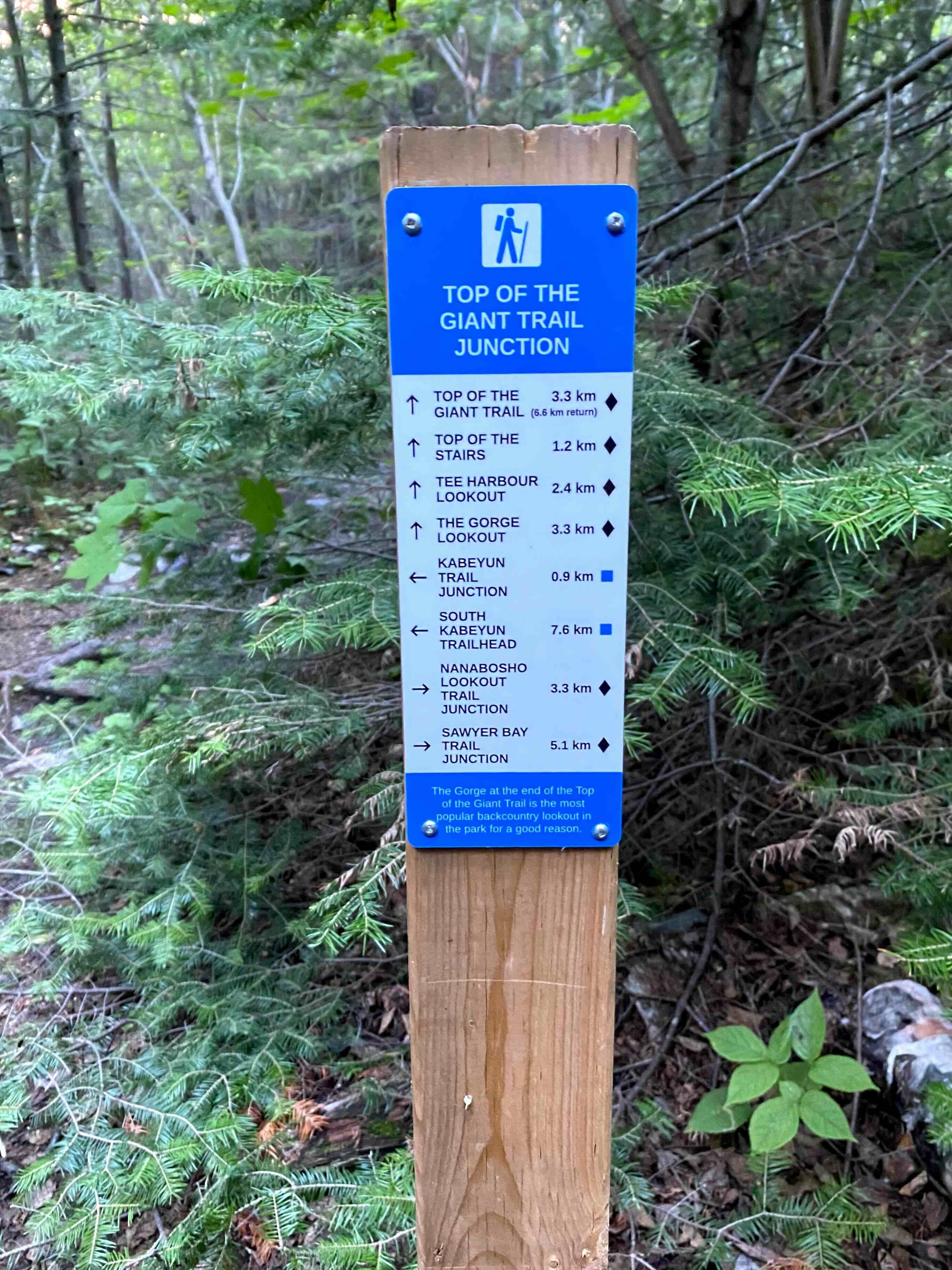
This next part of the trail is called "The Top of the Stairs" and it's the most challenging part of the hike, where you ascend 200 metres in 1.2 kilometres. These stairs were finished in 2002, making this trail possible! We took many water breaks along this section, but since it's such a short distance, it's over relatively quickly. Don't let the name fool you though, these aren't actual stairs, but rather a very steep, rugged climb.
The last part of the trail to the top of the giant is still uphill but only another 90 metres. The first lookout you come to is Tee Harbour Lookout (1.2km from the stairs). This is a beautiful view of the meadow and lake, looking down onto Tee Harbour far below.
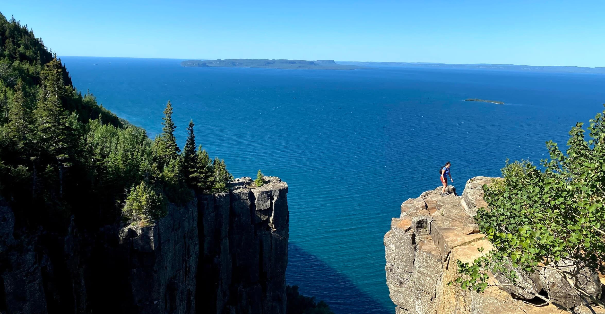
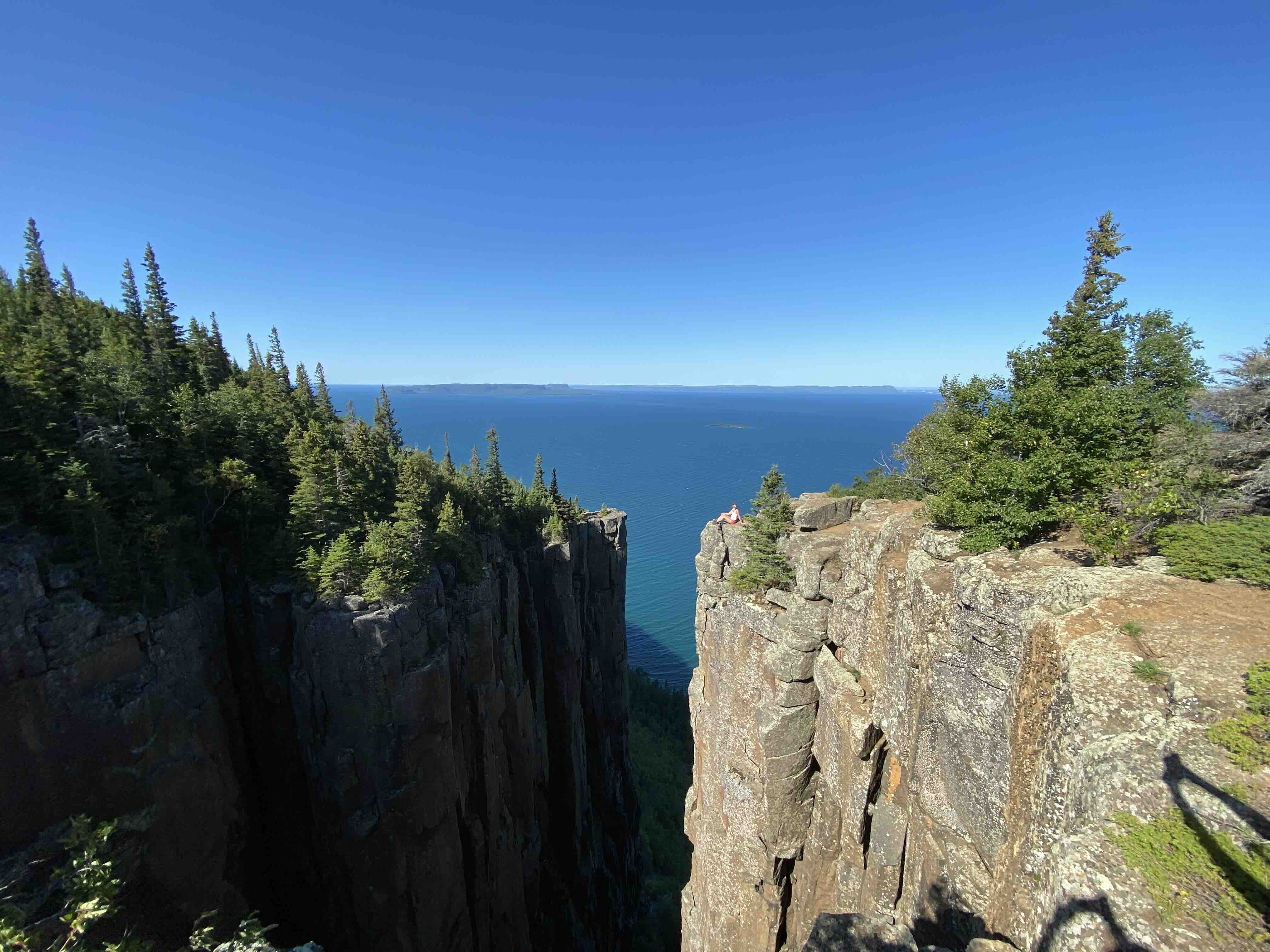
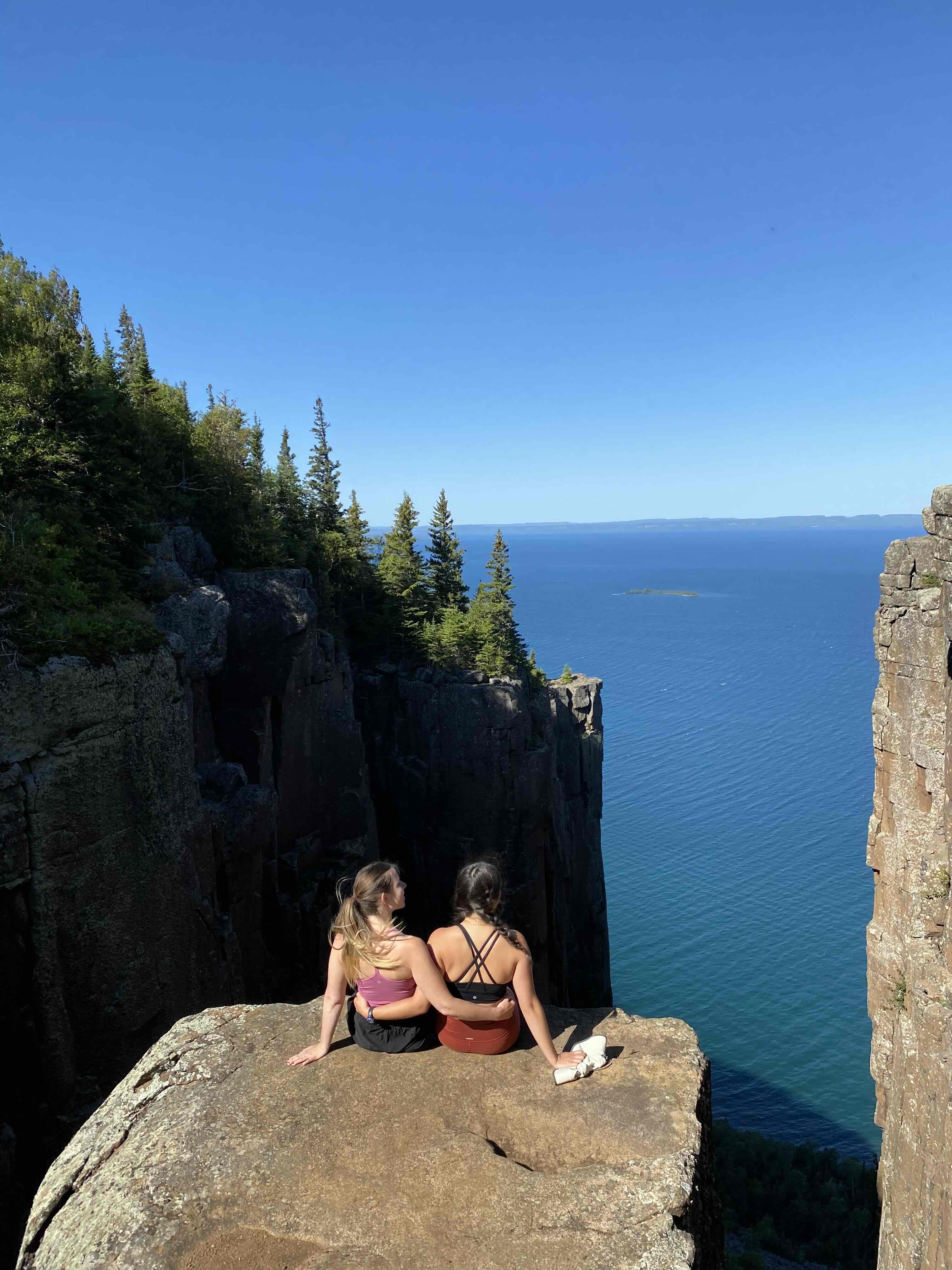
Finally, the last part of the hike to "The Gorge" is 0.9 kilometres. The Gorge is the famous view you'll see in all the photos of Sleeping Giant. The cliffs here are the tallest in Ontario and really make the hike worth all the sweat and exhausted feet. We managed to complete the climb in an hour and 45 minutes from Tee Harbour and were the first ones there, giving us our own private view for 30 minutes. Standing on those cliffs, looking out over Lake Superior with the wind in your face, is an experience that's hard to put into words.
The descent is way easier than the climb. We headed back down around 11am, and this is when we started encountering many hikers coming up. Getting to the top before 11am should ensure you have a relatively private experience at the summit.
⭐ Tip: Start early! The earlier you start, the better chance you have of experiencing The Gorge without crowds. This is the main benefit to camping at Tee Harbour the night before. You get a head start on day hikers and the view is absolutely spectacular and worth every bit of effort.
| Name | Sleeping Giant Trail (Top of the Giant) |
| Distance | 22km return from trailhead, 5-6 hours |
| Terrain | Flat to Tee Harbour, steep rocky ascent on Top of the Stairs, rocky terrain to summit |
| Level | Challenging |
Once we returned to Tee Harbour, we made lunch, took a quick dip in the lake to cool off, and then started the 1 hour hike back to the car. If you are coming to Northern Ontario, I highly recommend you do this hike! Never have I been so proud to call Ontario my home!
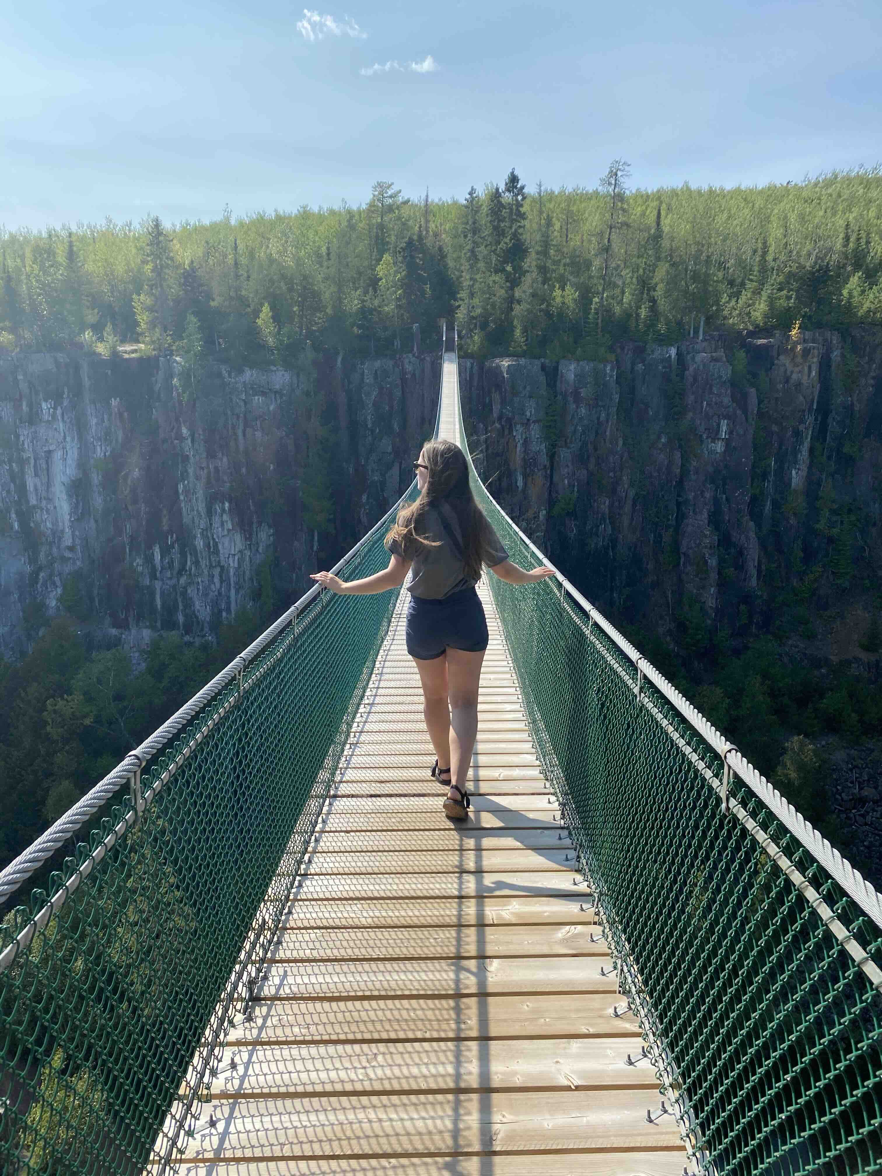
On our way back from Sleeping Giant toward Red Rock, we stopped at Eagle Canyon to walk across Canada's longest suspension bridge. There are actually two bridges as part of this experience, but as it is privately owned, it does cost $20 per adult (2020 price). They also have a zipline, but it was closed due to COVID during our visit. The view from the bridge was extremely picturesque, and the loop had picnic benches, so it's potentially a good place to bring lunch and make a morning or afternoon of it.
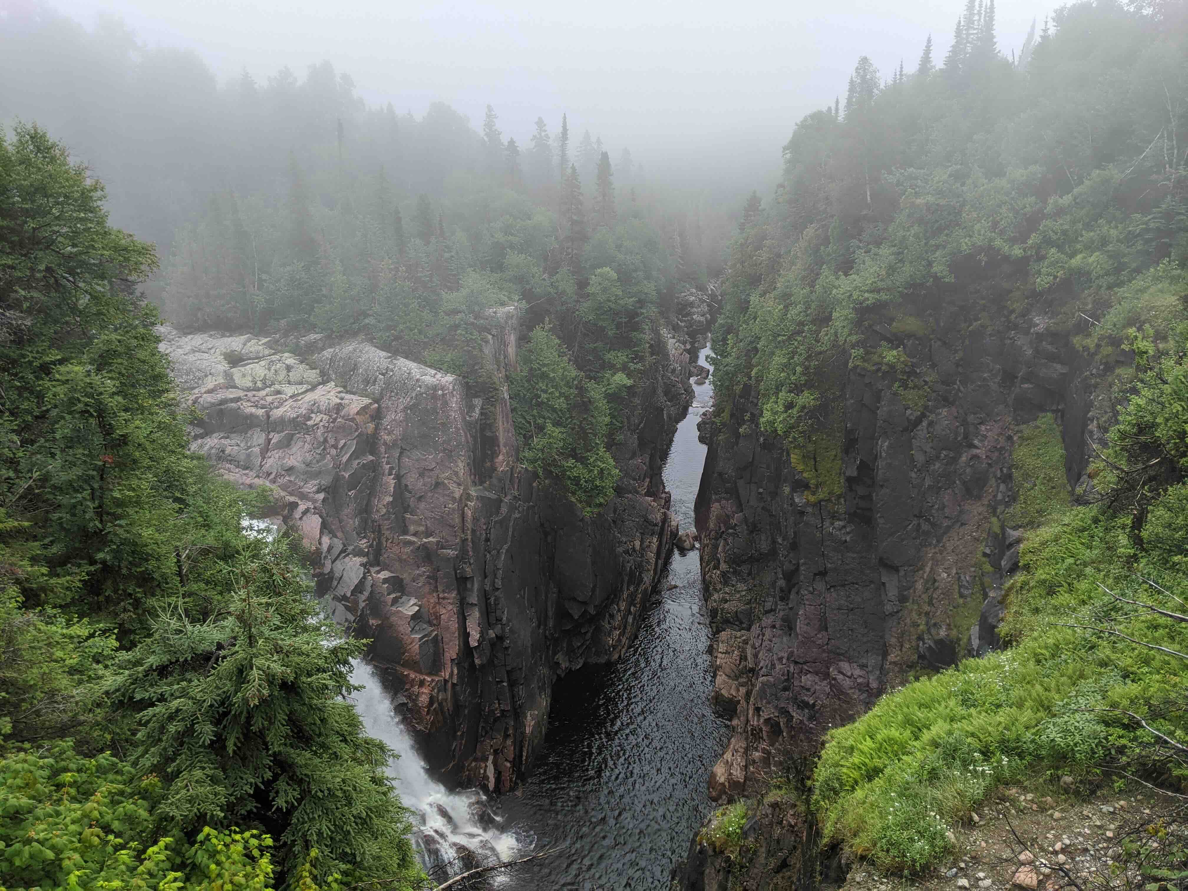
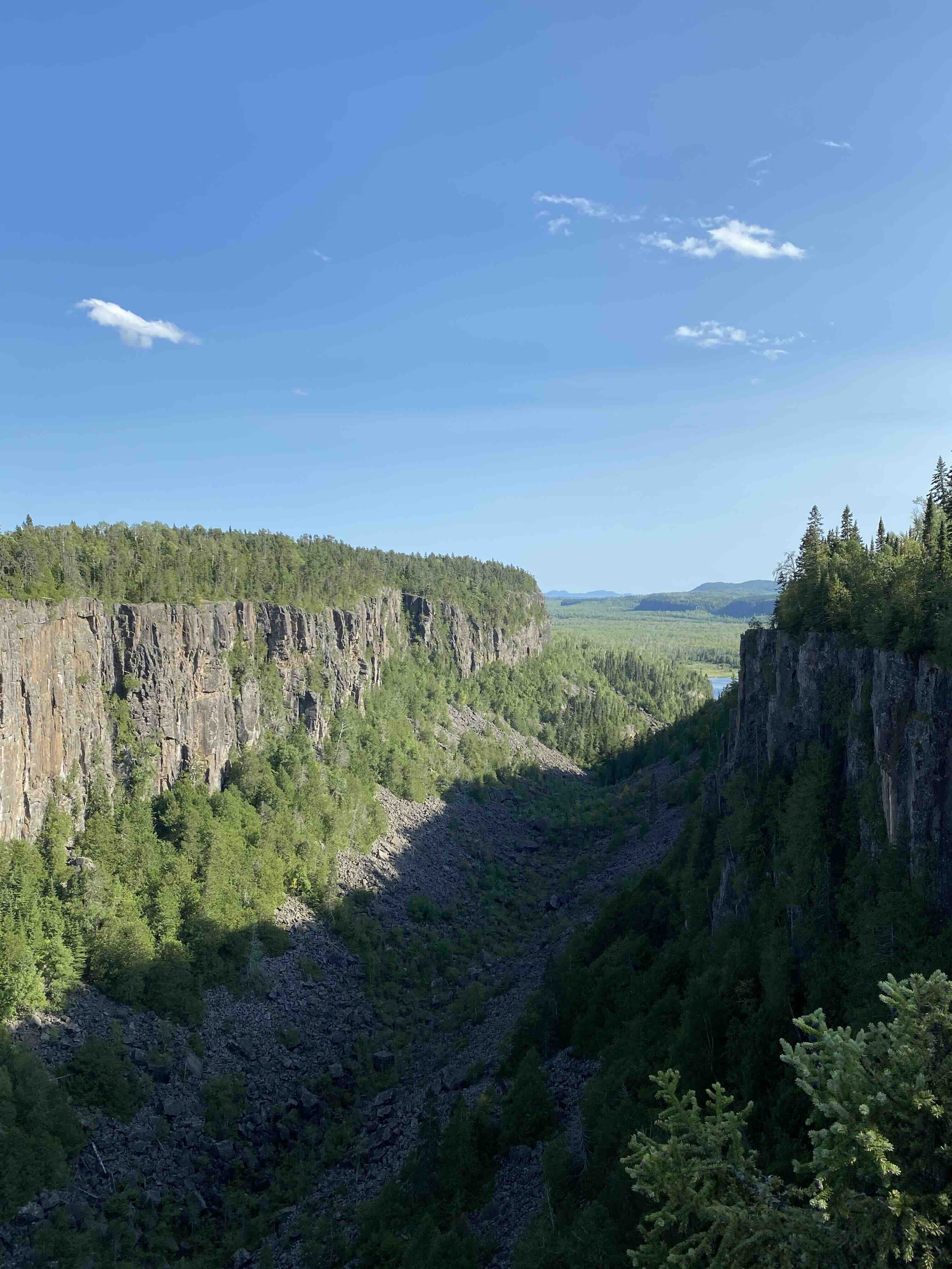
We also stopped at Ouimet Provincial Park for an easy, flat boardwalk hike loop of 1.8 kilometres. The trail brings you across a bridge and to two lookouts to view the canyon. If you're wanting to see the canyon views, I would recommend doing both lookouts because they're only 10 minutes apart. The area is known as canyon country, and it definitely lives up to its name.
| Name | Ouimet Canyon Trail |
| Distance | 1.8km loop, 30 minutes |
| Terrain | Flat boardwalk |
| Level | Easy |
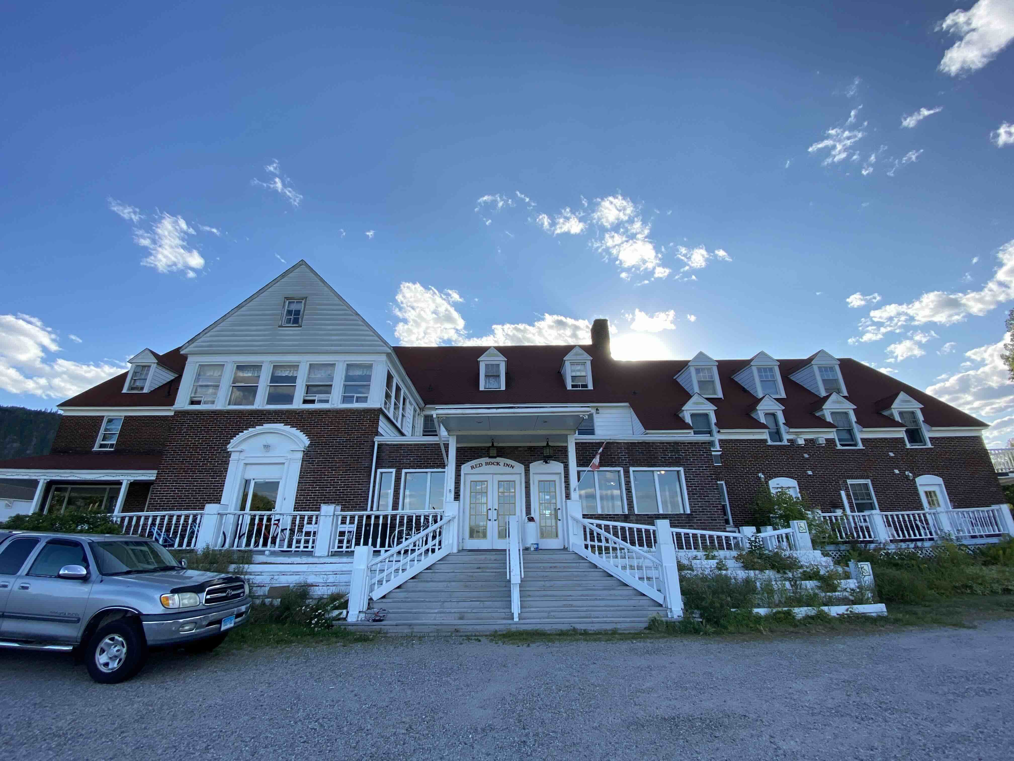
Tuesday night, we decided to stay at the Red Rock Inn to break up part of the drive back home. The Inn is a historic property which was being restored by the owner, Don, who was absolutely the highlight of our stay. He gave us great suggestions for hikes and views within the area and was incredibly welcoming. The rooms at the inn were clean and comfortable and the bathrooms had recently been redone with large soaker tubs, something we really appreciated after a very long day of hiking. After two nights of camping and a challenging summit hike, that soak was pure heaven.
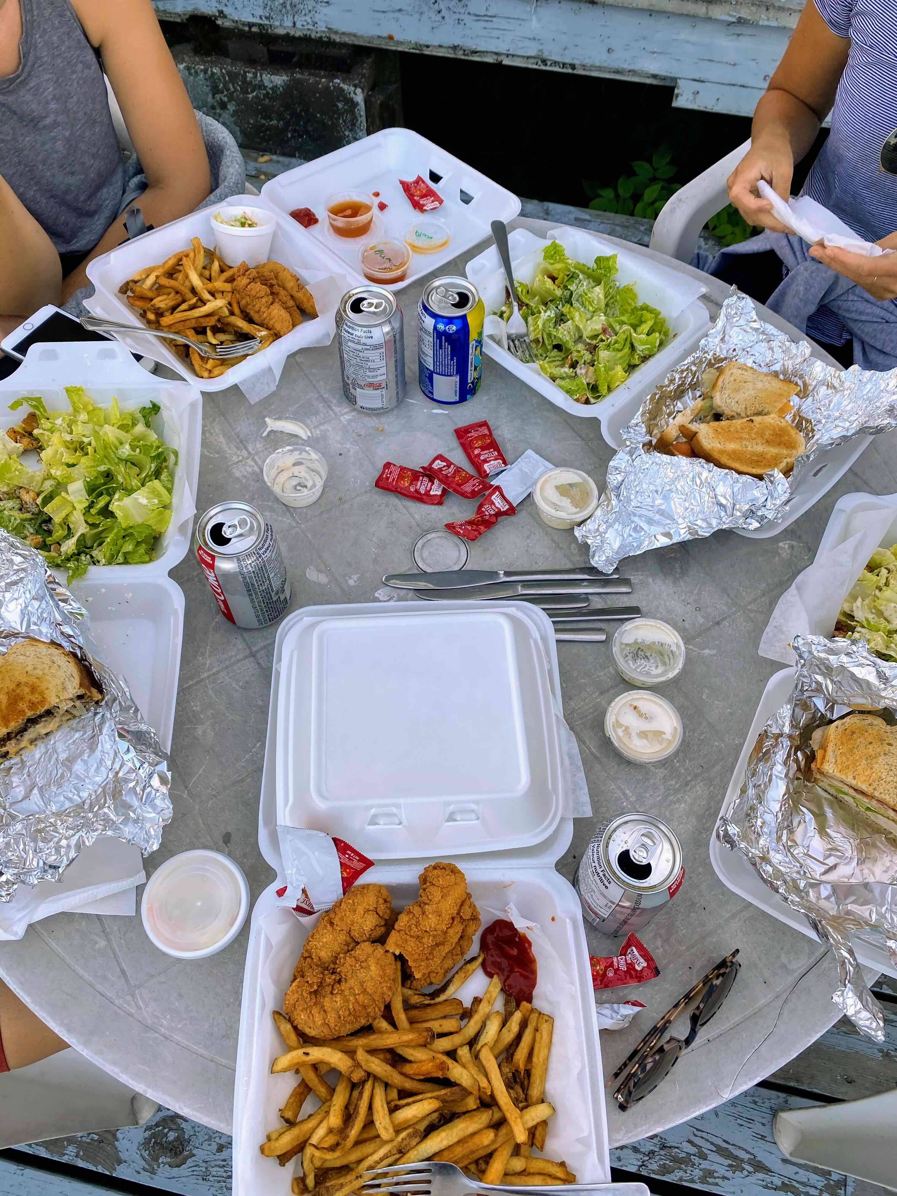
⭐ Tip: If you arrive after 6pm, almost everything in Red Rock is closed. Don pointed us to a small cafe in the community centre, a 3 minute walk from the Inn. We ordered takeout and ate it on the porch of the Inn, taking in the beautiful view of the lake. The cafe offers everything from chicken tenders to steak and potatoes, a great, reasonably priced meal and definitely a very local spot.
Sleeping Giant Provincial Park absolutely lived up to the hype. The combination of backcountry camping at Tee Harbour and summiting the giant made for an unforgettable experience. Yes, it's challenging, but standing on Ontario's tallest cliffs with Lake Superior stretching out before you is worth every step. This is the kind of adventure that reminds you why Ontario's wilderness is so special.

